S.I. No. 298/1996 - European Communities (Conservation of Wild Birds) (Amendment) (No. 2) Regulations, 1996.
S.I. No. 298 of 1996. | ||
EUROPEAN COMMUNITIES (CONSERVATION OF WILD BIRDS) (AMENDMENT) (NO. 2) REGULATIONS, 1996. | ||
I, MICHAEL D. HIGGINS, Minister for Arts, Culture and the Gaeltacht, in exercise of the powers conferred on me by section 3 of the European Communities Act, 1972 (No. 27 of 1972), for the purpose of giving further effect to Council Directive of 2 April 1979 on the conservation of wild birds (79/409/EEC)1, hereby make the following Regulations: | ||
1O.J. No. L103/1, 25/04/1979. 1. (1) These Regulations may be cited as the European Communities (Conservation of Wild Birds) (Amendment) (No. 2) Regulations, 1996. | ||
(2) These Regulations shall come into operation on 15th day of October, 1996. 2. The European Communities (Conservation of Wild Birds) Regulations, 1985 ( S.I. No. 291 of 1985 ), is hereby amended in the Schedule, by the addition of the following paragraphs after paragraph 77. | ||
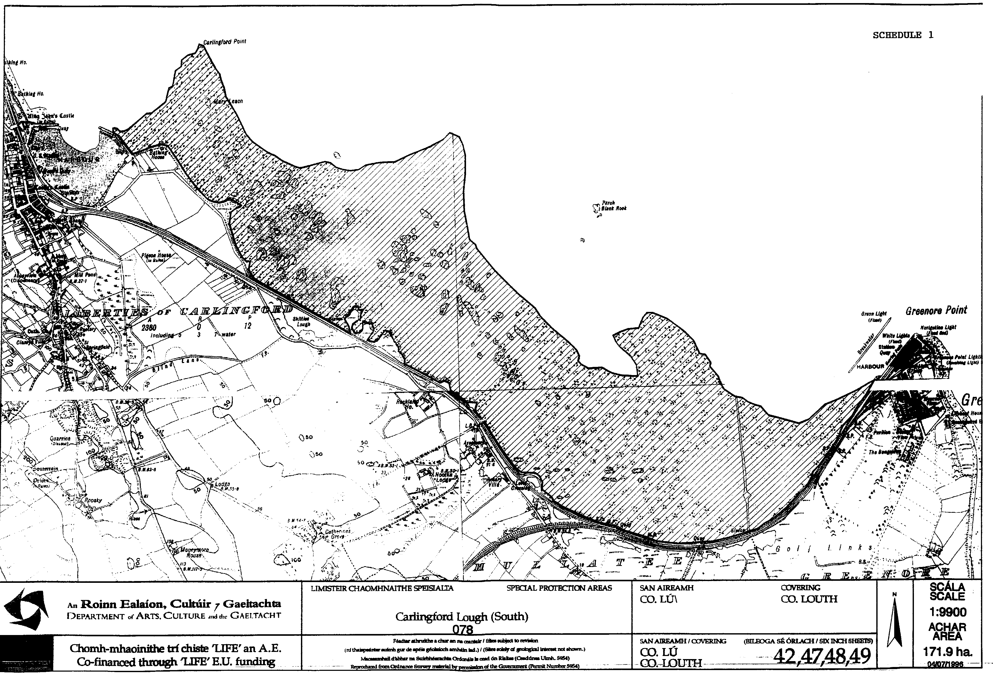
"78. Carlingford Lough in the county of Louth | ||
The area of foreshore known as Carlingford Lough situated in the county of Louth enclosed on the map in Schedule 1 of these Regulations within the inner margins of the black lines and hatched thereon in black. | ||
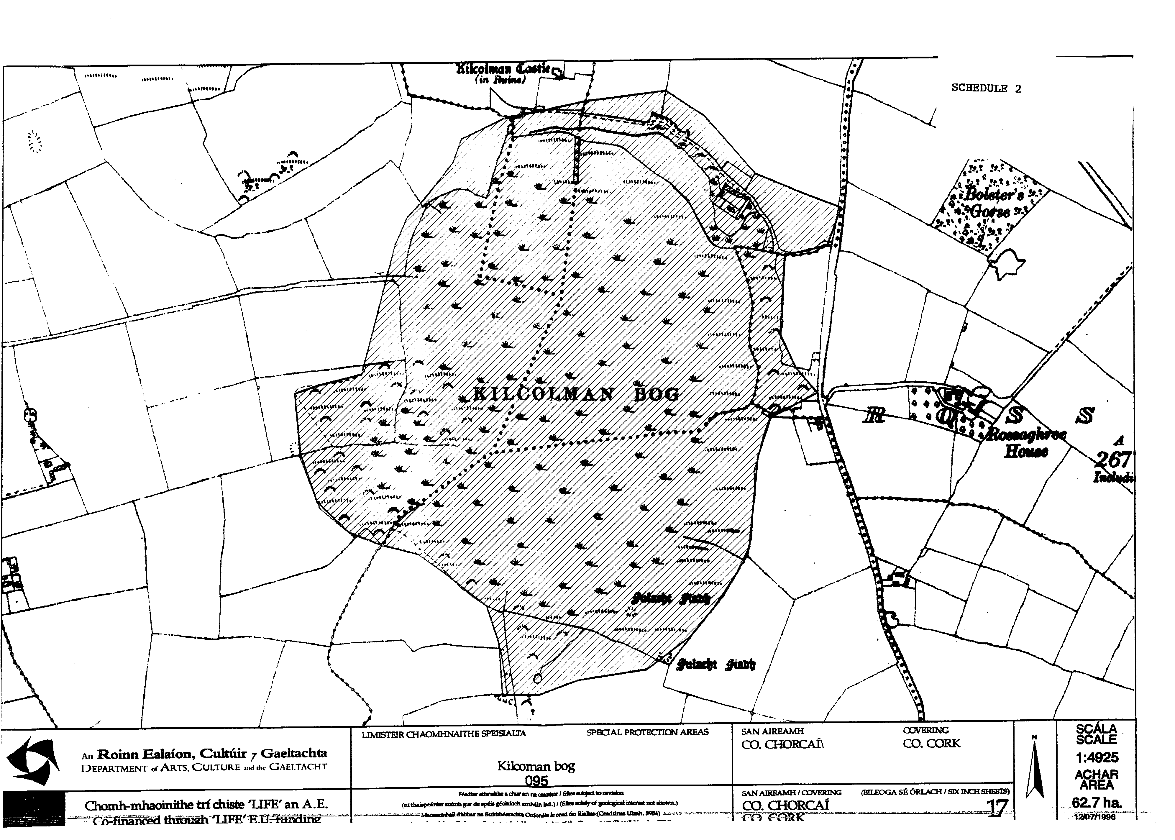
79. Kilcolman Bog in the county of Cork | ||
The area of land known as the Kilcolman Bog situated in the townlands of Rossagh West and Kilcolman West in the county of Cork enclosed on the map in Schedule 2 to these Regulations within the inner margins of the black line and hatched thereon in black. | ||
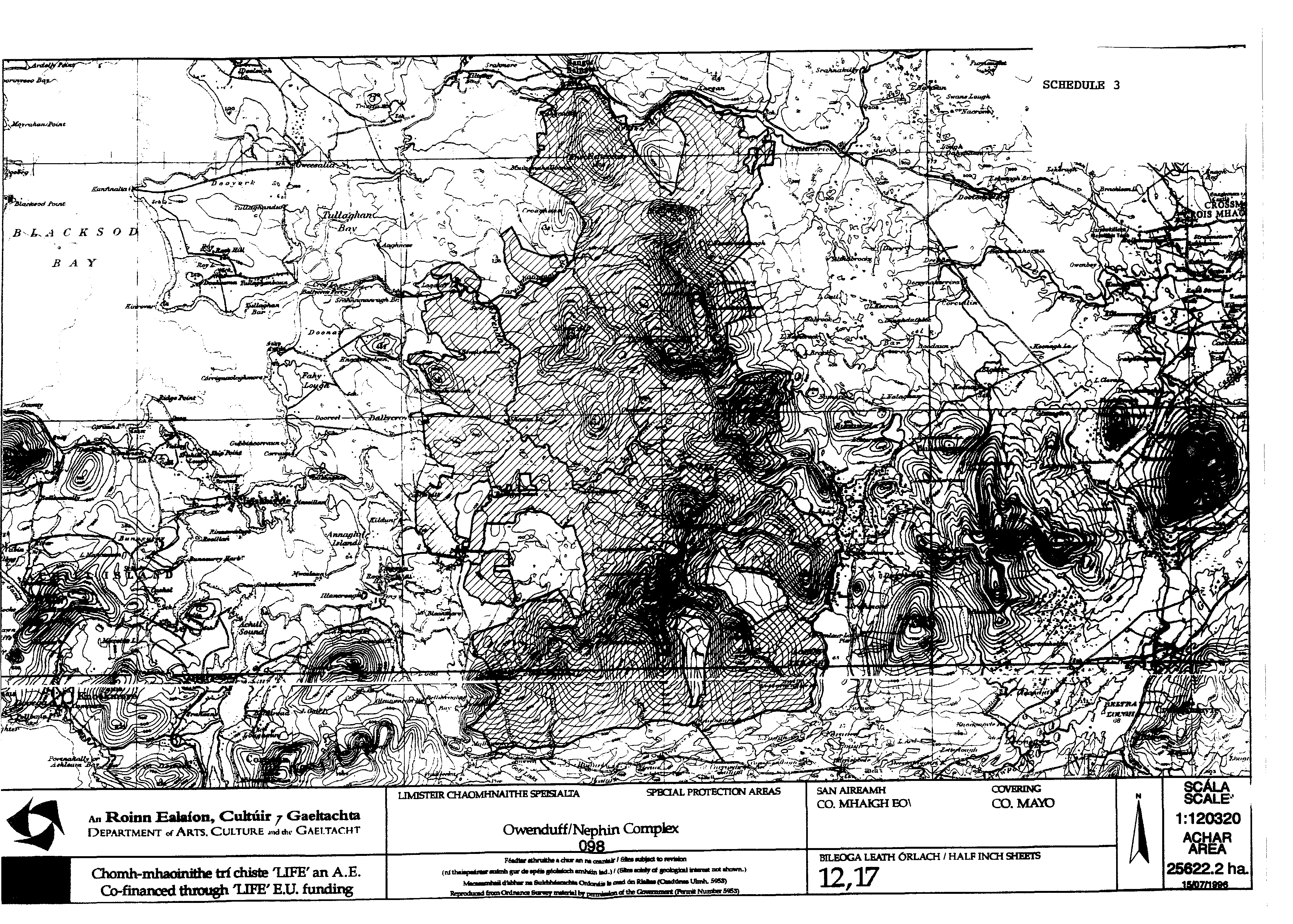
80. The Owenduff River Catchment and the Nephin Beg Mountain Range in the county of Mayo | ||
The area of land known as the Owenduff River Catchment and the Nephin Beg Mountain Range situated in the townlands of Bunmore West, Bunmore East, Briska, Srahederdaowen, Tarsaghaun Beg South, Tarsaghaun Beg North, Owenglass, Tarsaghaun More, Altnabrocky, Sheeanmore, Gortbrack South, Bellagarvaun, Castlehill, Scardaun, Maumaratta, Letterkeen, Letterask, Bellaveeny, Greenaun, Lagduff Beg, Lagduff More, Lettera, Clagganmountain, Croaghaun, Drumgollagh, Glenthomas, Essaun, Glennamong, Glenadahurk, Lettermaghera North, Lettermaghera South, Lough Feeagh, Lurgandarragh, Muingaghel, Muingnahalloona, Owenduff, Sheean, Srahacorick, Srahmore, Srahnamanragh, Tallagh, Tawnanasheffin, Treel, Uggool and Srahduggaun all in the county of Mayo enclosed on the map in Schedule 3 to these Regulations within the inner margins of the black line and hatched thereon in black. | ||
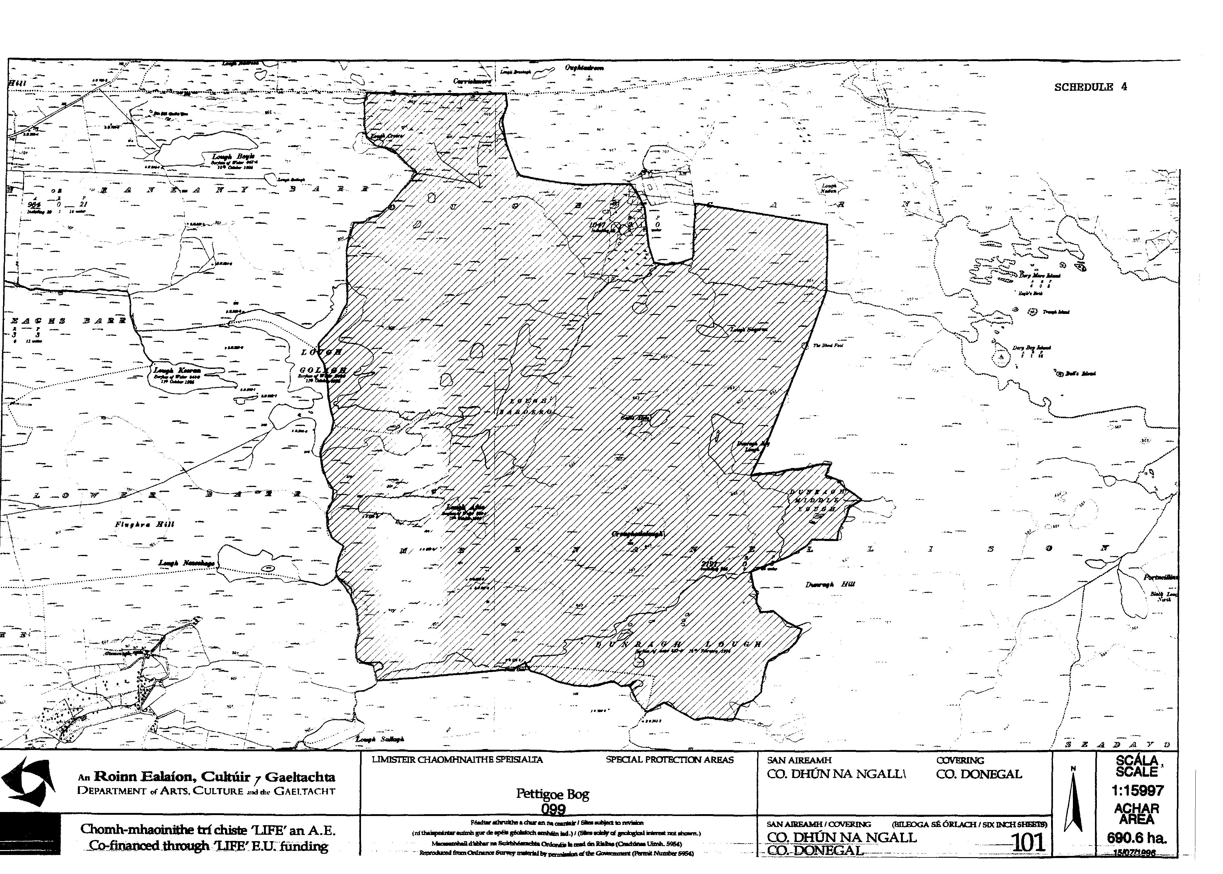
81. Pettigoe Plateau in the county of Donegal | ||
The area known as the Pettigoe Plateau situated in the townlands of Oughtcarn, Meenanellison and Meensheffin in the county of Donegal enclosed on the map in Schedule 4 to these Regulations within the inner margins of the black line and hatched thereon in black. | ||
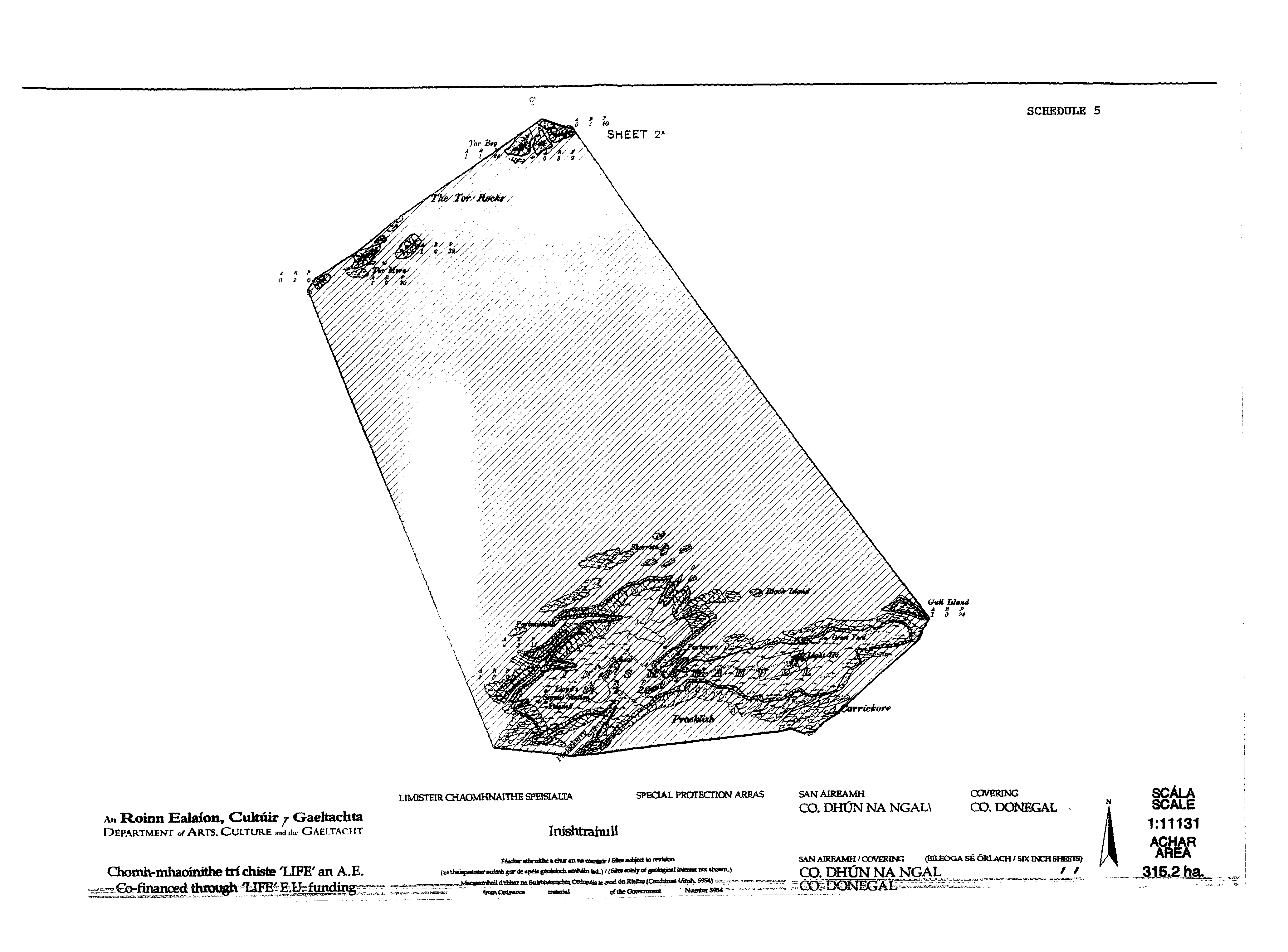
82. Inishtrahull in the county of Donegal | ||
The island known as Inishtrahull and adjacent islets and rocks situated in the county of Donegal enclosed on the map in Schedule 5 to these Regulations within the inner margins of the black line and hatched thereon in black. | ||
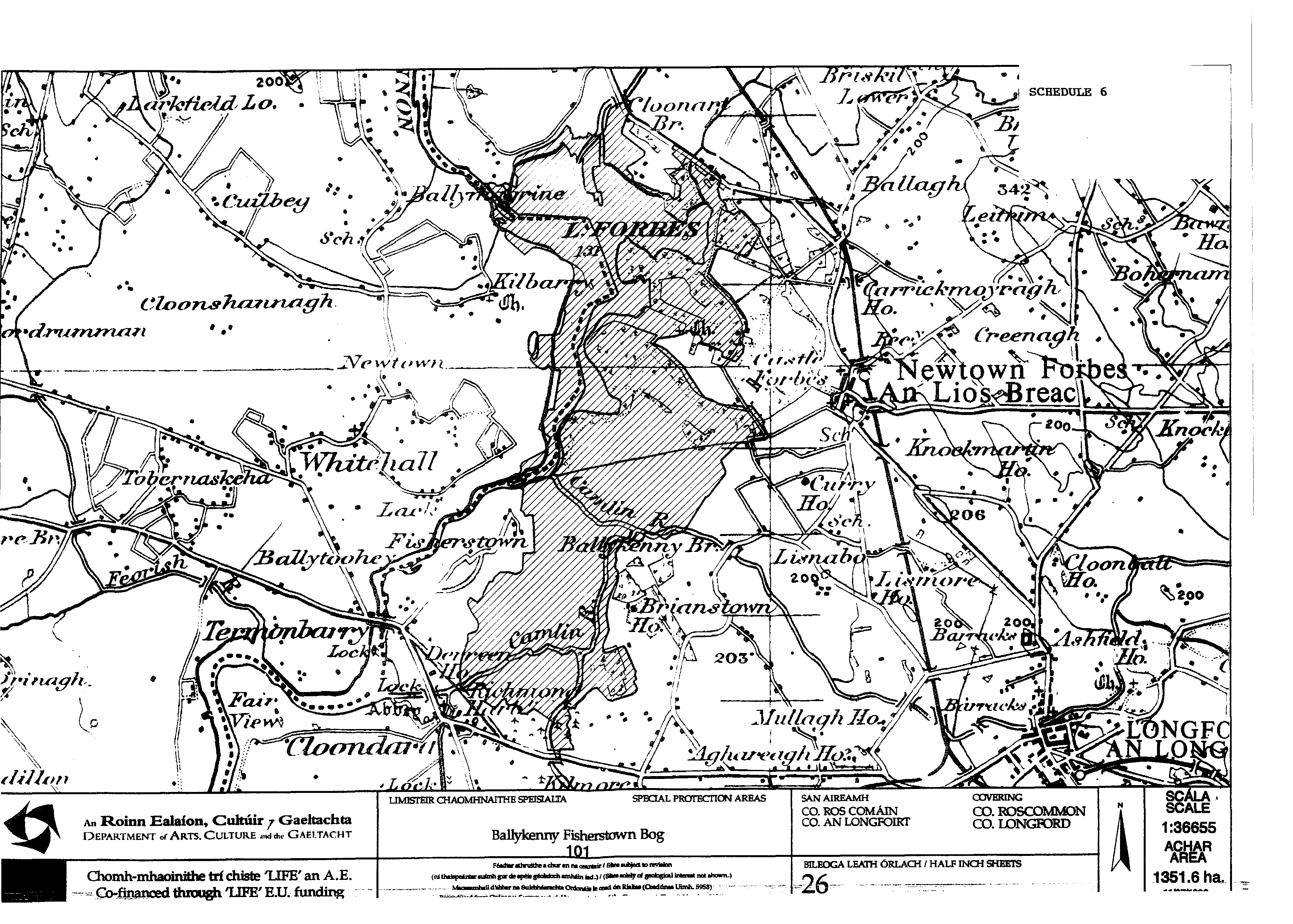
83. Lough Forbes and the Ballykenny and Fisherstown Boq Complex in the counties of Longford and Roscommon. | ||
The area of land known as Lough Forbes and the adjacent Ballykenny and Fisherstown Bog Complex situated in the townlands of Castle Forbes Demesne, Killeen, Cloondara and Kilbarry in the counties of Longford and Roscommon enclosed on the map in Schedule 6 to these Regulations within the inner margins of black line and hatched thereon in black. | ||
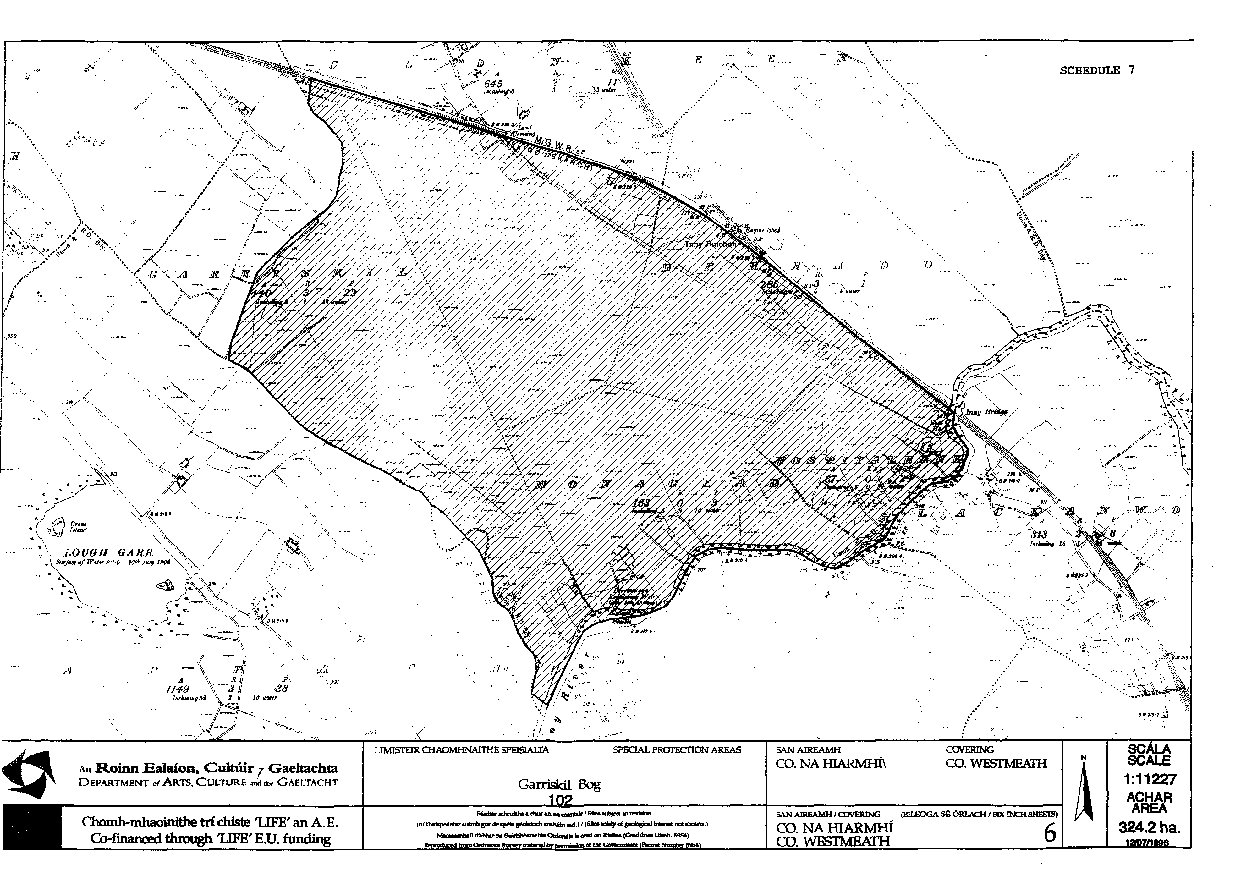
84. Garriskil Bog in the county of Westmeath | ||
The area of land known as Garriskil Bog situated in the townlands of Clonkeen, Garriskil, Monagead, Hospitalbank and Derradd in the county of Westmeath enclosed on the map in Schedule 7 to these Regulations within the inner margins of the black line and hatched thereon in black. | ||
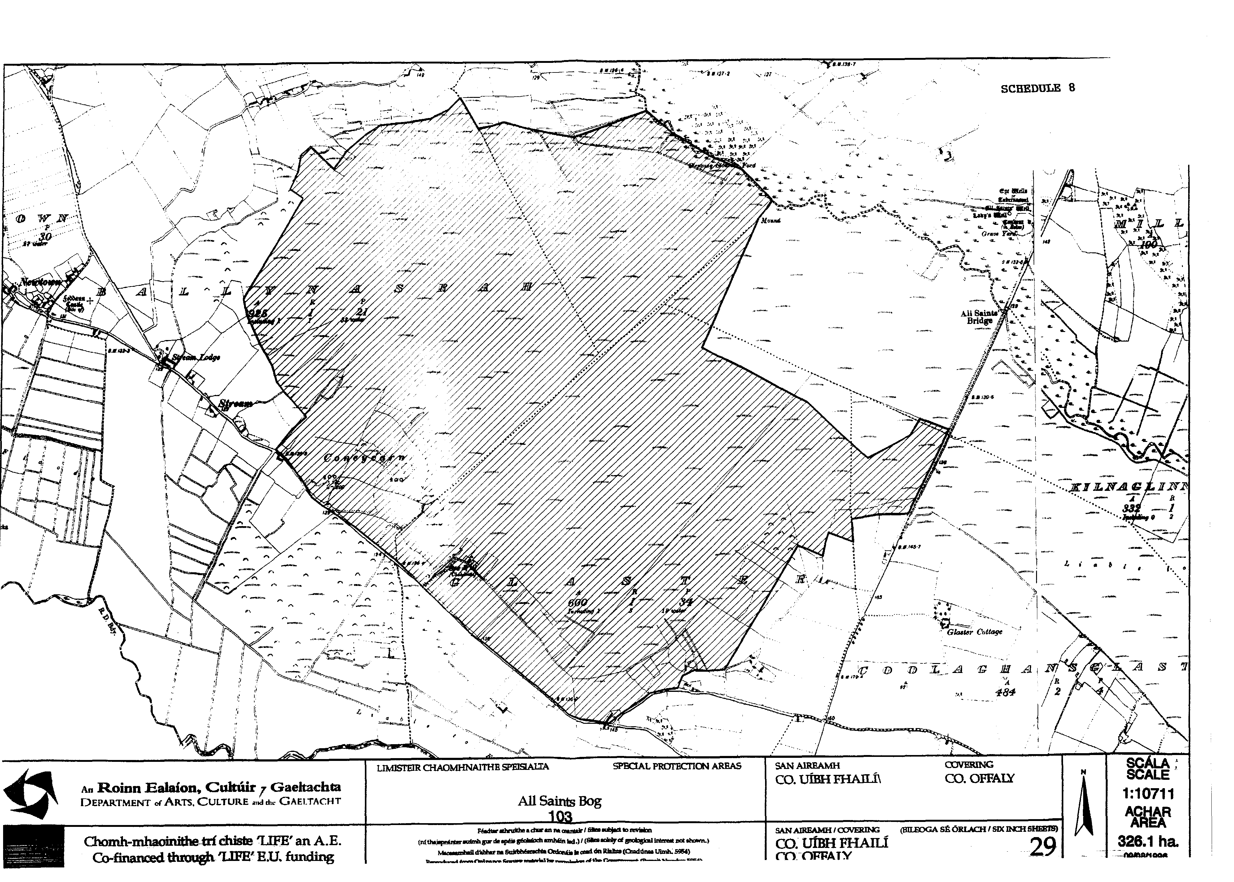
85. All Saints Bog in the county of Offaly | ||
The area of land known as All Saints Bog situated in the townlands of Ballynasrah and Glaster in the county of Offaly enclosed on the map in Schedule 8 to these Regulations within the inner margins of the black line and hatched thereon in black. | ||
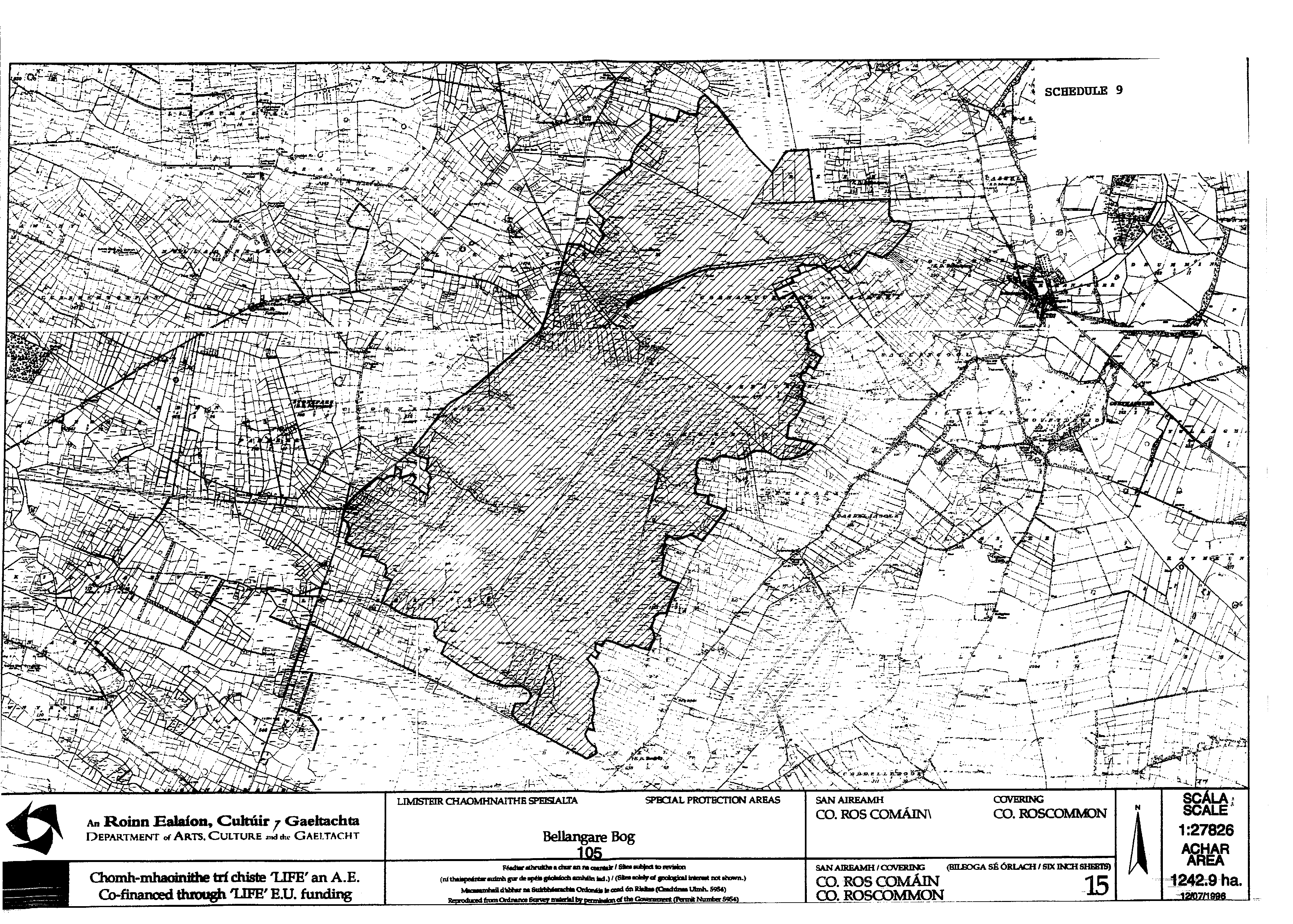
86. Bellangare Bog in the county of Roscommon | ||
The area of land known as Bellangare Bog situated in the townlands of Arraghan, Lugankeeran, Clooneinglas, Cornamucklagh and Falmore in the county of Roscommon enclosed on the map in Schedule 9 to these Regulations within the inner margins of the black line and hatched thereon in black. | ||
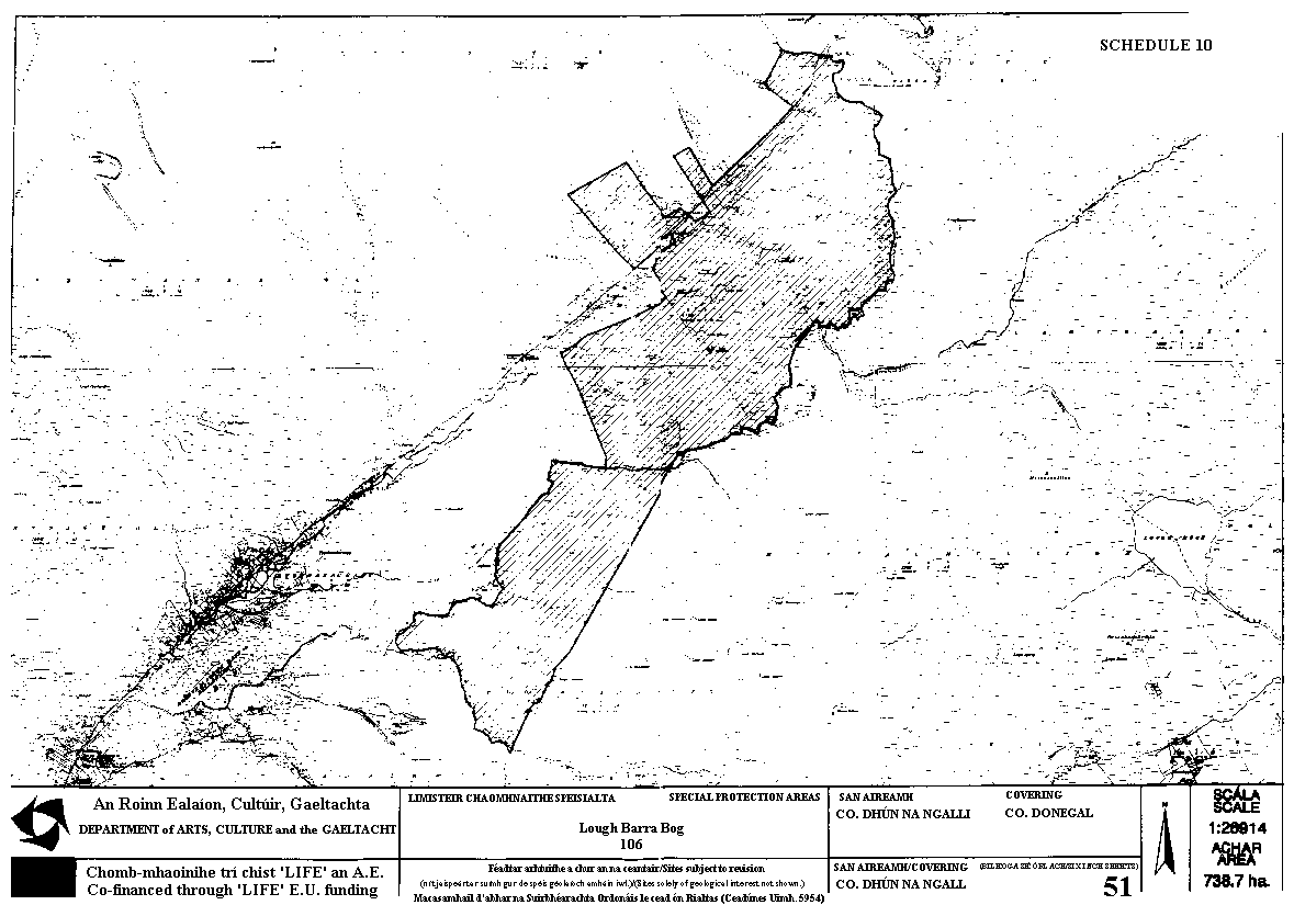
87. Lough Barra Bog in the county of Donegal | ||
The area of land known as Lough Barra Bog situated in the townlands of Comeen and Befflaght in the county of Donegal enclosed on the map in Schedule 10 to these Regulations within the inner margins of the black line and hatched thereon in black. | ||
88. Coole Park and Garryland Nature Reserve in the county of Galway | ||
The area of land known as Coole Park and Garryland Wood Reserve situated in the townlands of Coole Demesne, Garryland and Doonowen in the county of Galway enclosed on the map in Schedule 11 to these Regulations within the inner margins of the black line and hatched thereon in black. | ||
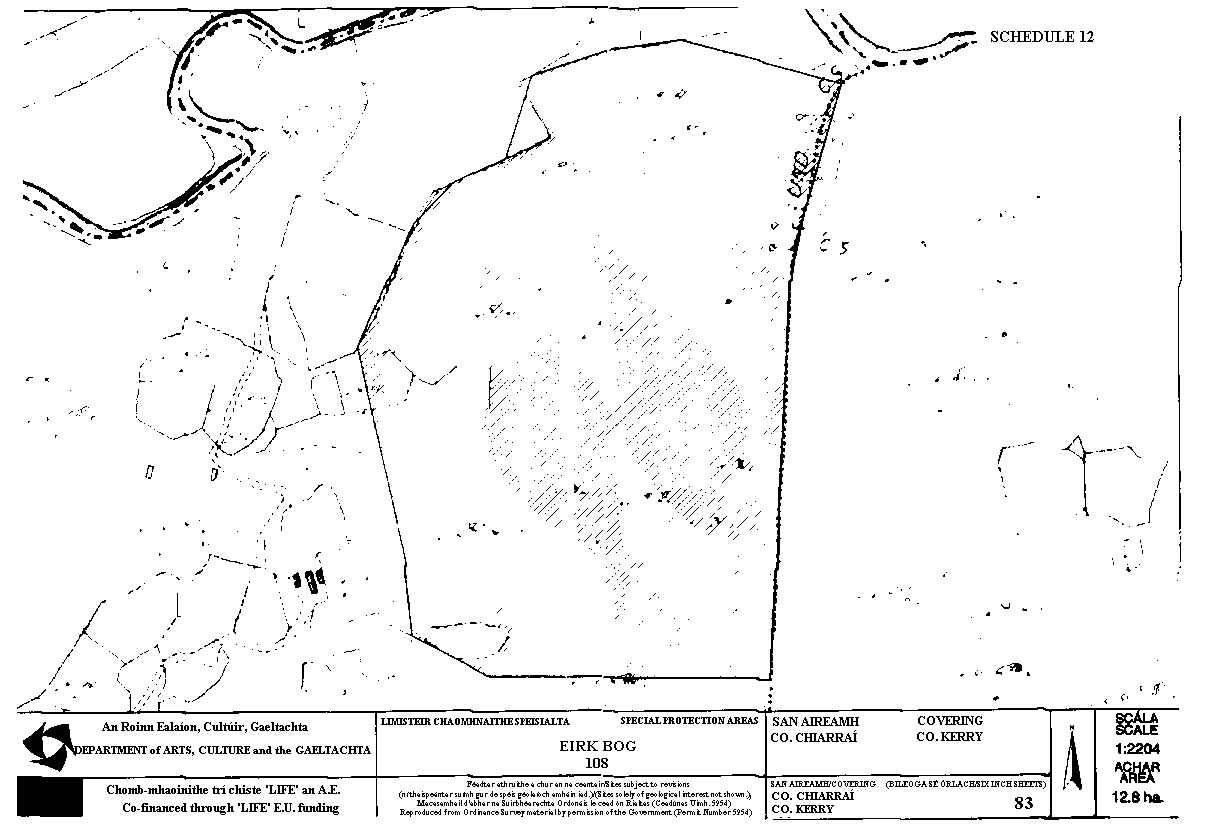
89. Eirk Bog in the county of Kerry | ||
The area of land known as Eirk Bog situated in the townland of Derrynafunsha in the county of Kerry enclosed on the map in Schedule 12 to these Regulations within the inner margins of the black line and hatched thereon in black. | ||
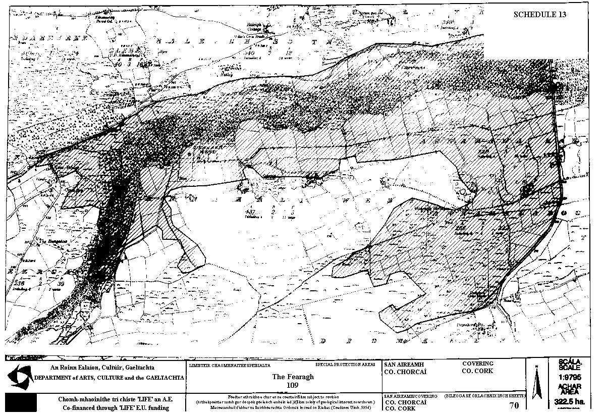
90. The Gearagh in the county of Cork | ||
The area of land known as The Gearagh situated in the townlands of Annahala Bog, Annahala East, Annahala West, Dromkeen, Tullatreada, Raleigh South, Teergay, Dundareirke and Glebe all in the county of Cork enclosed on the map in Schedule 13 to these Regulations within the inner margins of the black line and hatched thereon in black. | ||
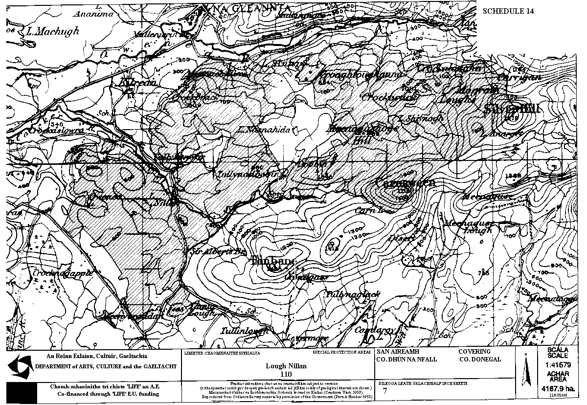
91. Lough Nillan Bog in the county of Donegal | ||
The area of land known as Lough Nillan Bog situated in the townlands of Croaghanarget, Cronacarrfree, Lagnagillen, Meenaki, Meenawannia, Kilrean Upper, Derries, Meenachallow, Croankeeran all in the county of Donegal enclosed on the map in Schedule 14 to these Regulations within the inner margins of the black line and hatched thereon in black." | ||
GIVEN under my Official Seal, this 8th day of October, 1996. | ||
Michael D. Higgins, | ||
Minister for Arts, Culture and the Gaeltacht. | ||
EXPLANATORY NOTE | ||
Council Directive of 2 April, 1979, on the conservation of wild birds (79/409/EEC) provides for the conservation of wild birds by, among other things, classifying important ornithological sites as Special Protection Areas for them. The effect of these Regulations is to classify an additional fourteen sites as Special Protection Areas in accordance with Article 4 of the Directive and to provide that contravention of the provisions of these Regulations shall constitute an offence. | ||
| ||
|
Carlingford Lough (South) | ||
| ||
|
Kilcoman bog | ||
| ||
|
Owenduff/Nephin Complex | ||
| ||
|
Pettigoe Bog | ||
| ||
|
Inishtrahull | ||
| ||
|
Ballykenny Fisherstown Bog | ||
| ||
|
Garriskil Bog | ||
| ||
|
All Saints Bog | ||
| ||
|
Bellangare Bog | ||
| ||
|
Lough Barra Bog | ||
| ||
|
Coole/Garryland | ||
| ||
|
Eirk Bog | ||
| ||
|
The Gearagh | ||
| ||
|
Lough Nillan | ||
|