S.I. No. 287/1995 - European Communities (Conservation of Wild Birds) (Amendment) (No. 5) Regulations, 1995.
S.I. No. 287 of 1995. | ||
EUROPEAN COMMUNITIES (CONSERVATION OF WILD BIRDS) (AMENDMENT) (NO. 5) REGULATIONS, 1995. | ||
I, MICHAEL D. HIGGINS, Minister for Arts, Culture and the Gaeltacht, in exercise of the powers conferred on me by section 3 of the European Communities Act, 1972 (No. 27 of 1972), for the purpose of giving further effect to Council Directive No. 79/409/EEC of 2 April, 19791O.J. , hereby make the following Regulations: | ||
1 O.J. No. L103/1. 25/4/1979. 1. (1) These Regulations may be cited as the European Communities (Conservation of Wild Birds) (Amendment) (No. 5) Regulations, 1995. | ||
(2) These Regulations shall come into operation on the 1st day of December, 1995. 2. The European Communities (Conservation of Wild Birds) Regulations, 1985 ( S.I. No. 291 of 1985 ), is hereby amended in the Schedule, by the addition of the following paragraphs after paragraph 57: | ||
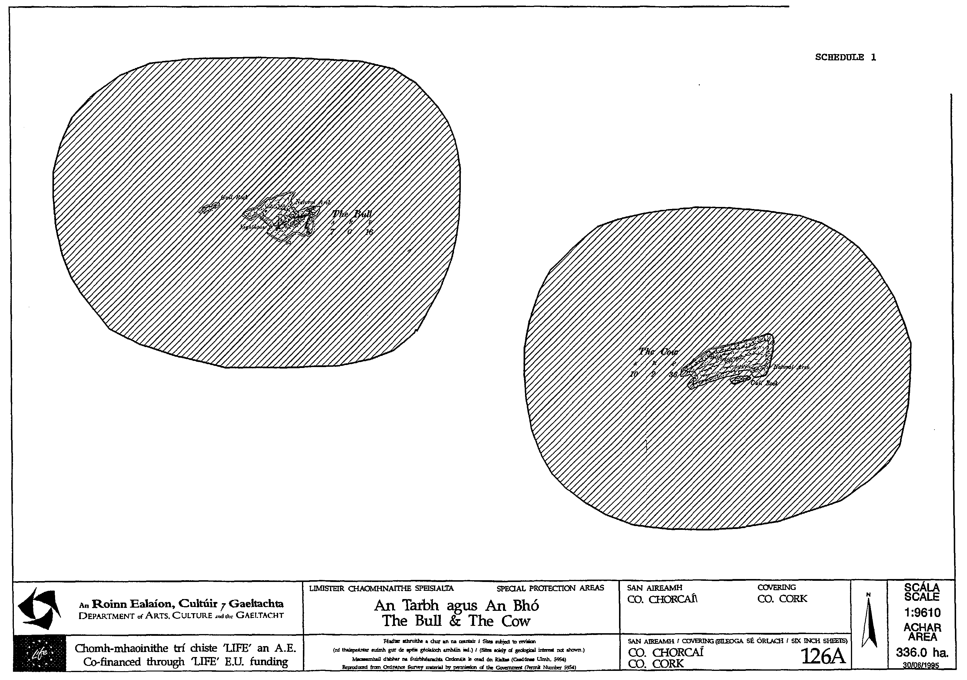
"58. The Bull and The Cow Rocks in the county of Cork | ||
The areas of land known as The Bull and The Cow Rocks comprising the main islands known as The Bull and The Cow Rocks and the adjacent Gull Rocks situated in the county of Cork and contiguous seashore, enclosed on the map in Schedule 1 to these Regulations within the inner margins of the black line and hatched thereon in black. | ||
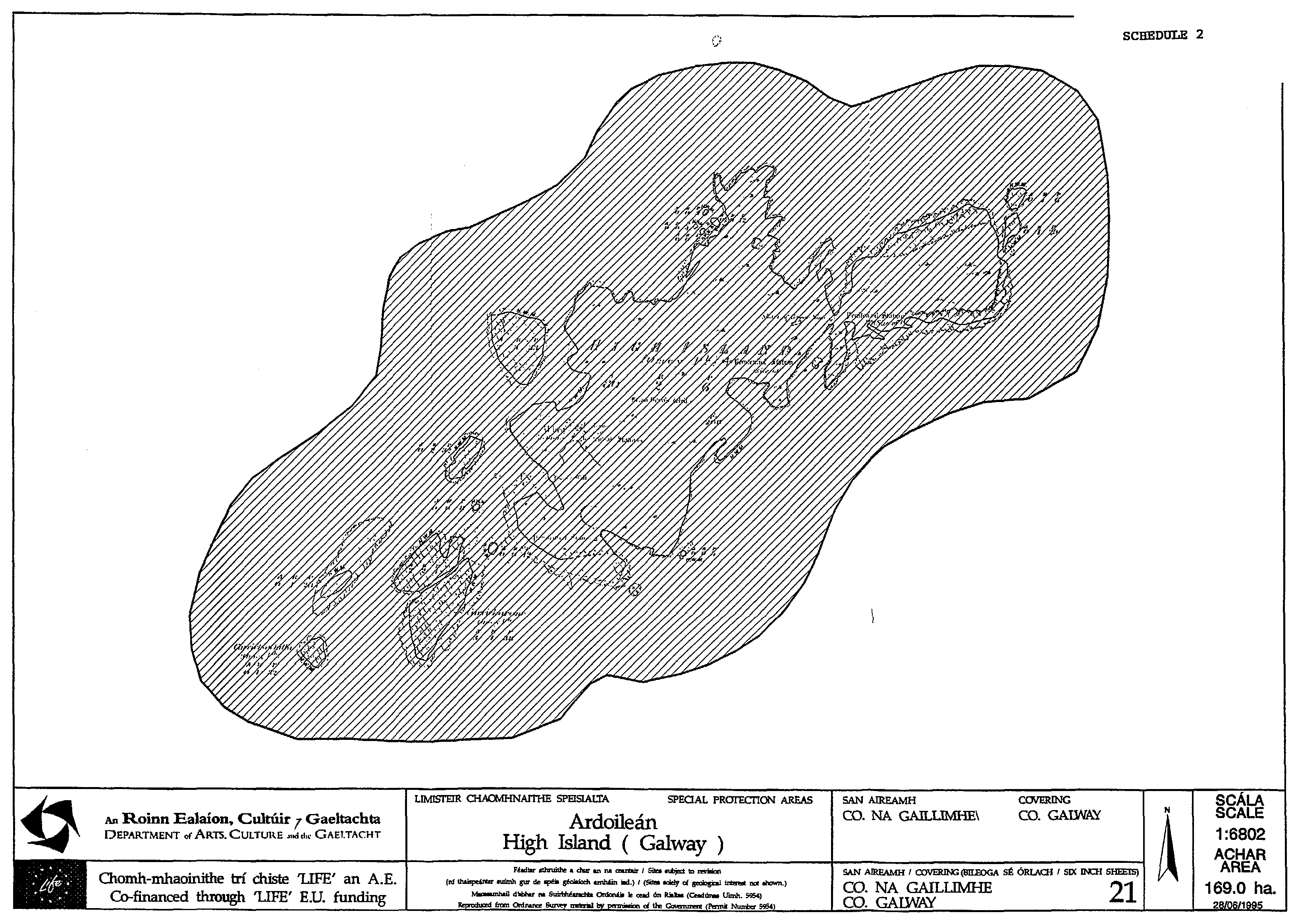
59. High Island in the county of Galway | ||
The area of land known as High Island comprising the main island known as High Island and adjacent islets and rocks situated in the county of Galway and contiguous seashore, enclosed on the map in Schedule 2 to these Regulations within the inner margins of the black line and hatched thereon in black. | ||
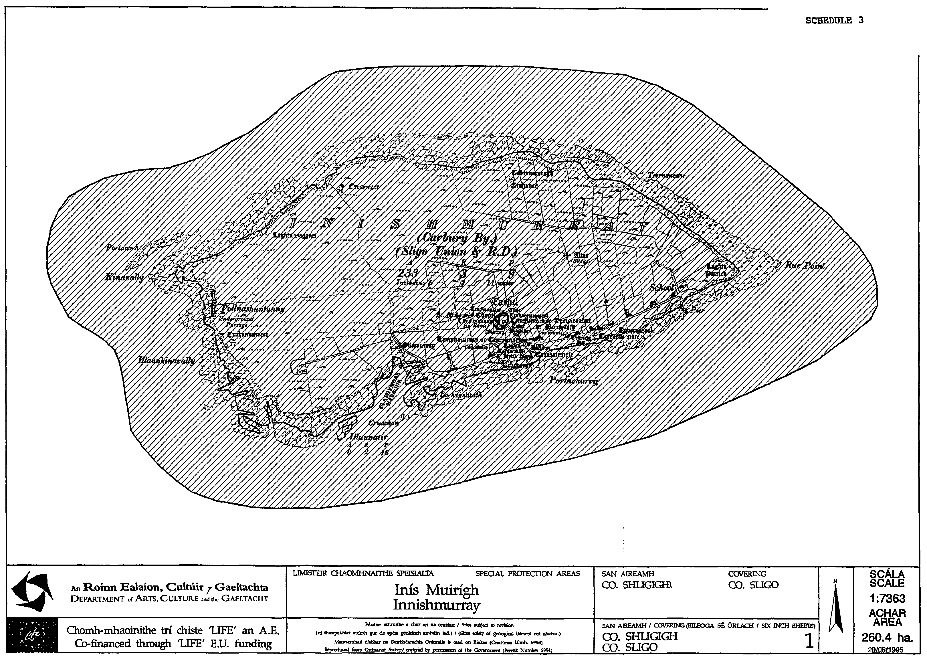
60. Inishmurray in the county of Sligo | ||
The area of land known as Inishmurray comprising of the main island known as Inishmurray and surrounding islets and rocks situated in the county of Sligo and contiguous seashore, enclosed on the map in Schedule 3 to these Regulations within the inner margins of the black line and hatched thereon in black. | ||
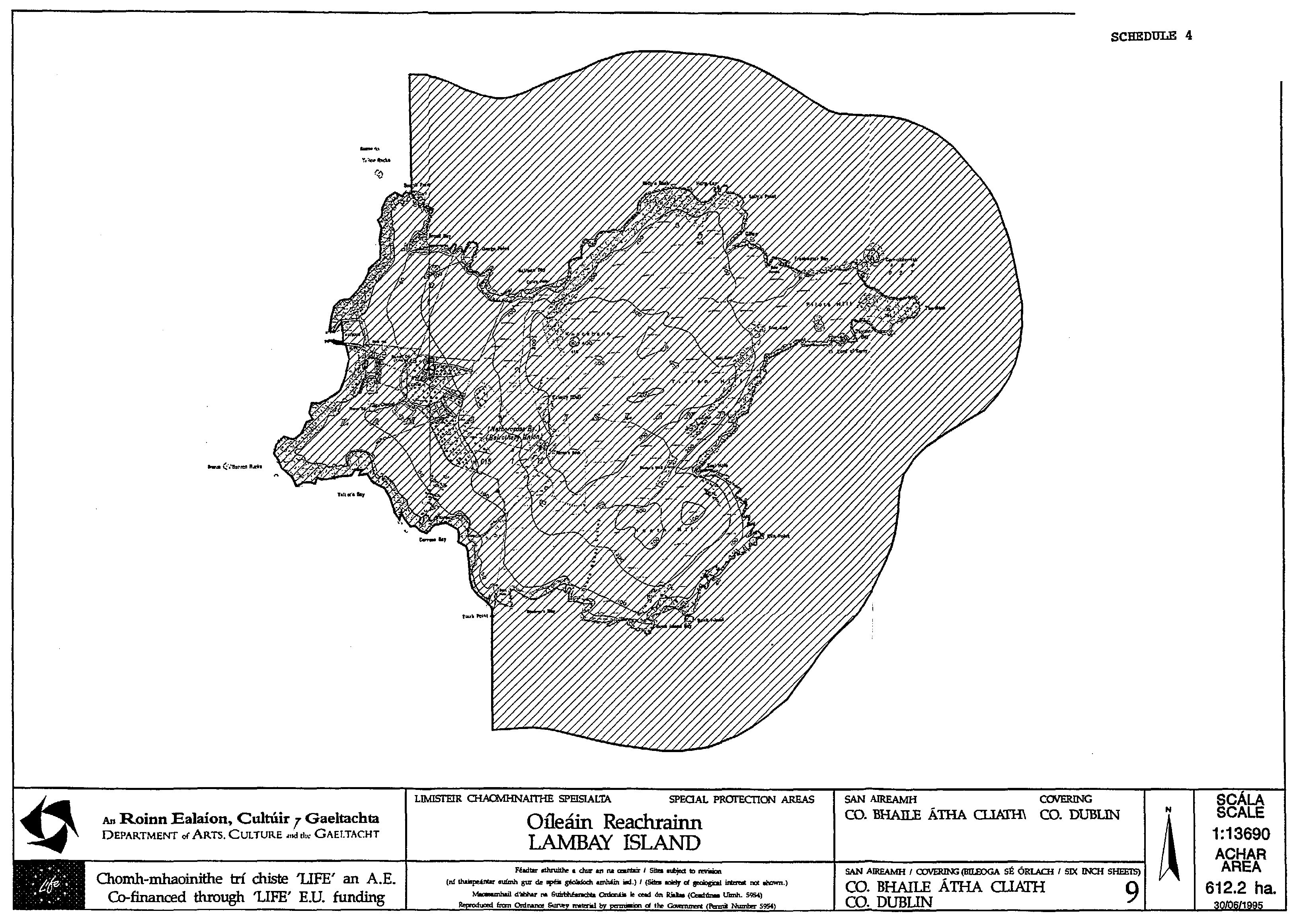
61. Lambay Island in the county of Dublin | ||
The area of land known as Lambay Island comprising of the main island known as Lambay Island and surrounding islets and rocks situated in the county of Dublin and contiguous seashore, enclosed on the map in Schedule 4 to these Regulations within the inner margins of the black line and hatched thereon in black. | ||
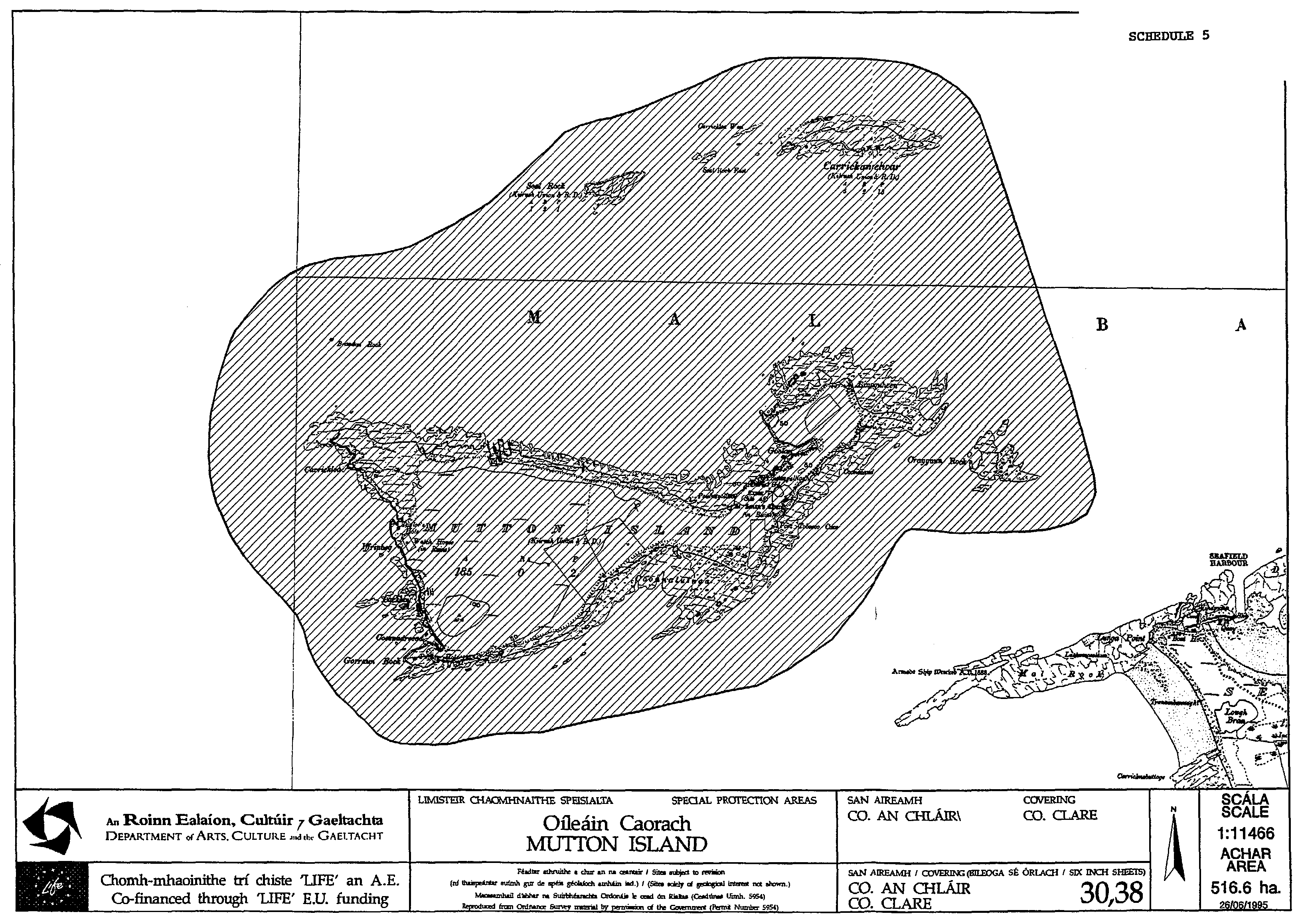
62. Mutton Island in the county of Clare | ||
The area of land known as Mutton Island comprising of the main island known as Mutton Island and surrounding islets and rocks situated in the county of Clare and contiguous seashore, enclosed on the map in Schedule 5 to these Regulations within the inner margins of the black line and hatched thereon in black. | ||
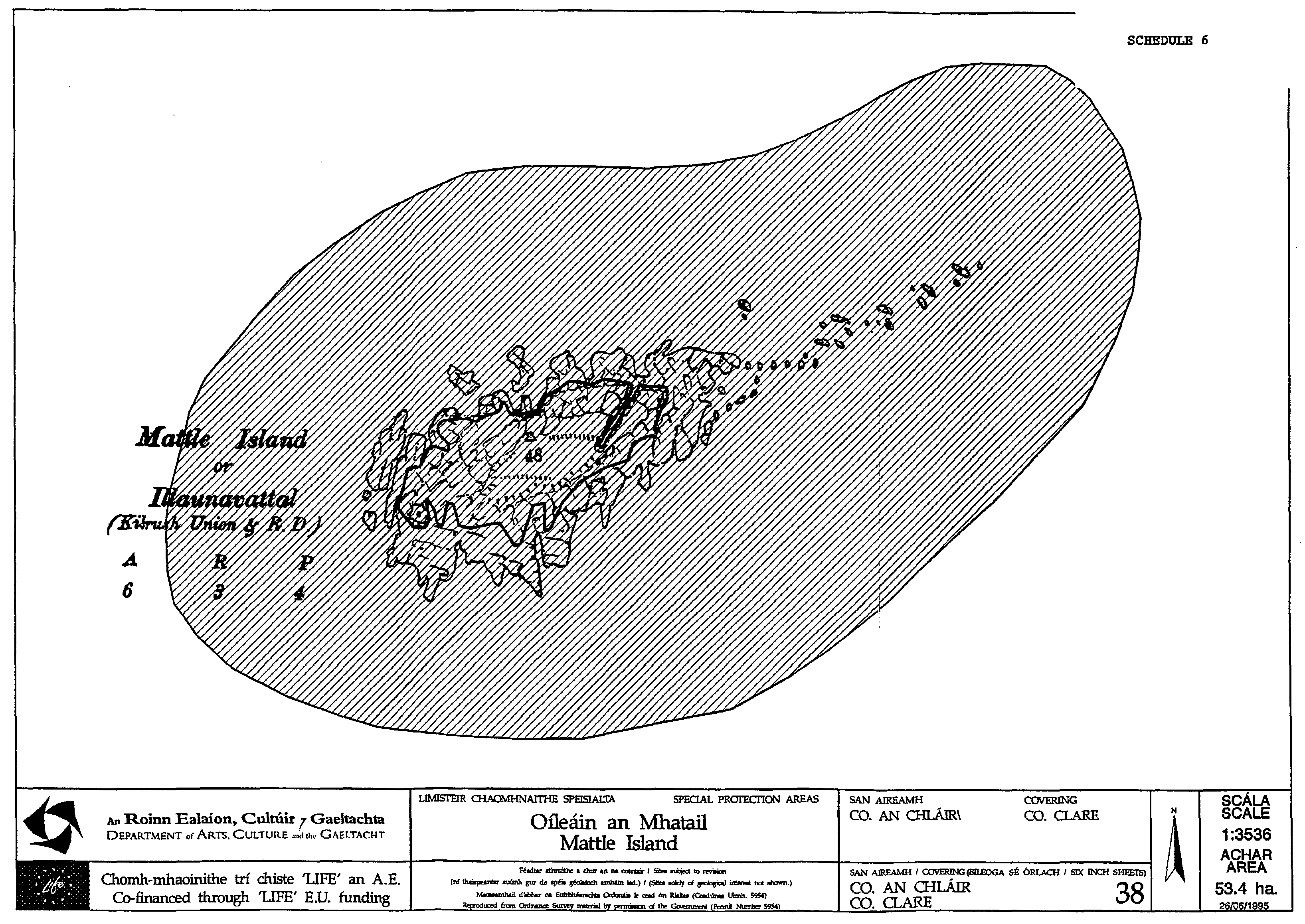
63. Mattle Island in the county of Clare | ||
The area of land known as Mattle Island comprising of the main island known as Mattle Island and surrounding islets and rocks situated in the county of Clare and contiguous seashore, enclosed on the map in Schedule 6 to these Regulations within the inner margins of the black line and hatched thereon in black. | ||
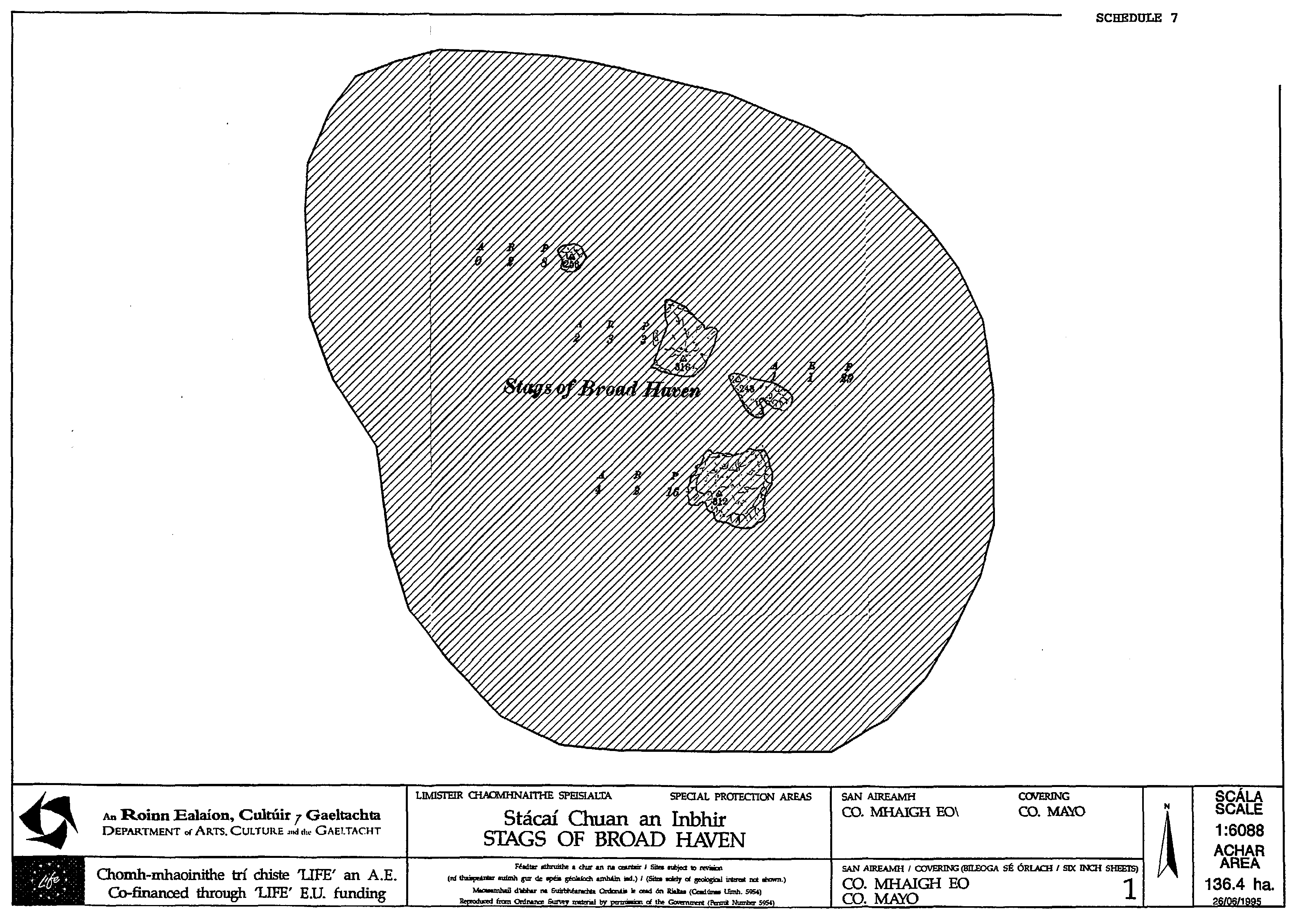
64. The Stags of Broadhaven in the county of Mayo | ||
The area of land known as the Stags of Broadhaven situated in the county of Mayo and contiguous seashore, enclosed on the map in Schedule 7 to these Regulations within the inner margins of the black line and hatched thereon in black. | ||
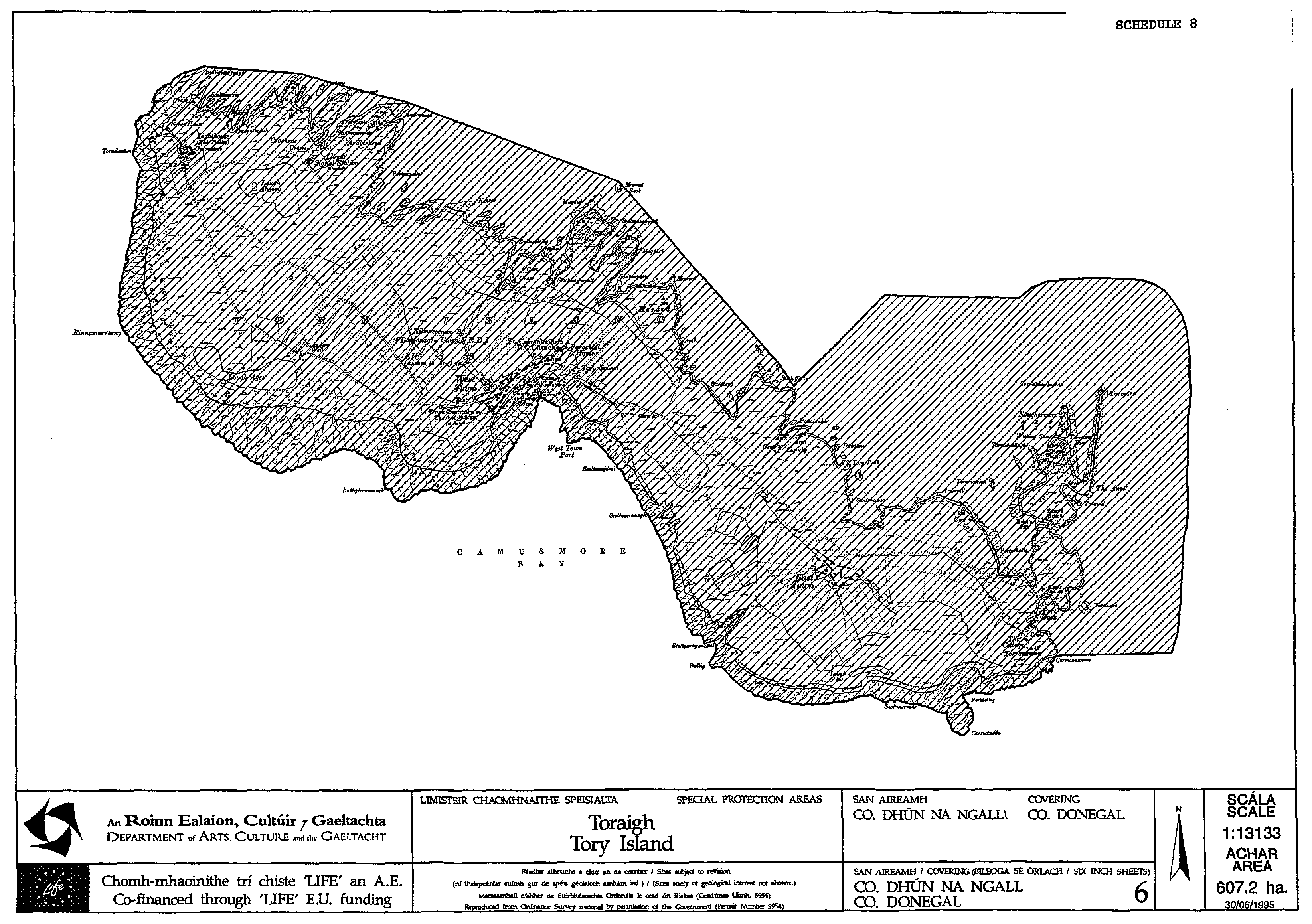
65. Tory Island in the county of Donegal | ||
The area of land known as Tory Island, comprising of the main island knows as Tory Island and surrounding islets and rocks situated in the county of Donegal and contiguous seashore, enclosed on the map in Schedule 8 to these Regulations within the inner margins of the black line and hatched thereon in black. | ||
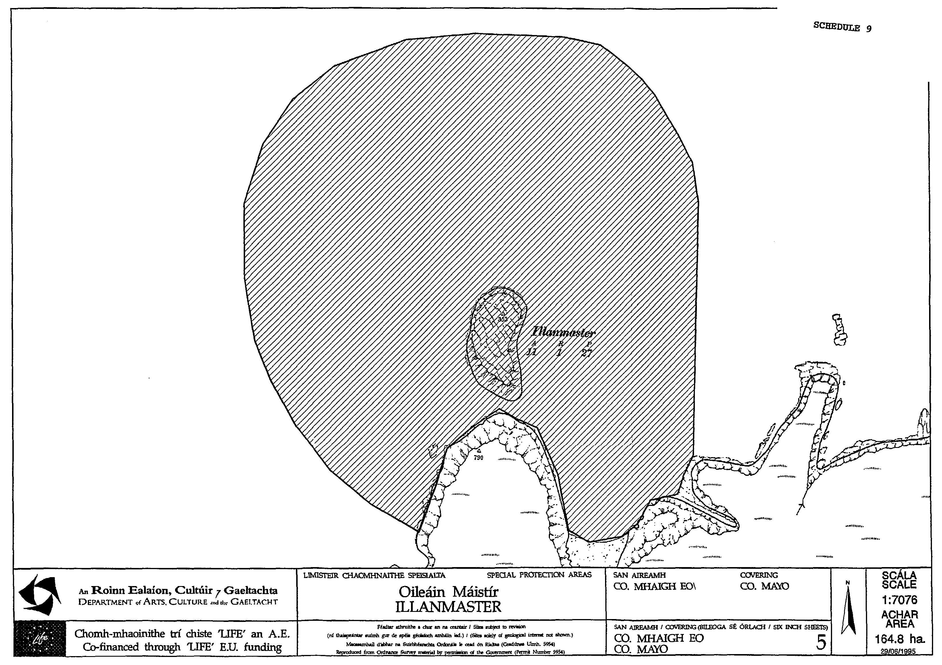
66. Illanmaster in the county of Mayo | ||
The area of land known as Illanmaster and surrounding islets and rocks situated in the county of Mayo and contiguous seashore, enclosed on the map in Schedule 9 to these Regulations within the inner margins of the black line and hatched thereon in black. | ||
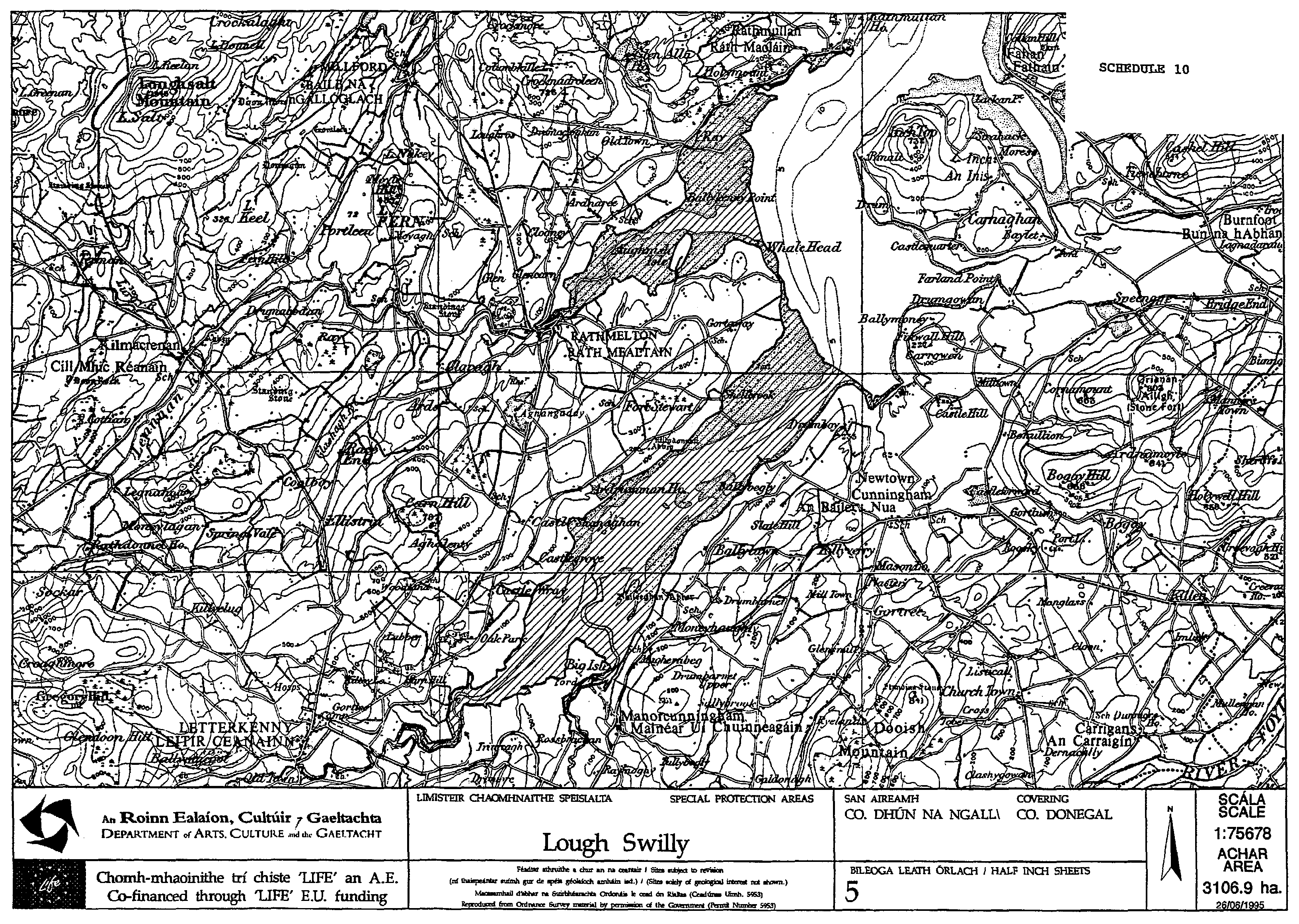
67. Lough Swilly in the county of Donegal | ||
The area of foreshore situated in Lough Swilly in the county of Donegal bounded by the high water mark, enclosed on the map in Schedule 10 to these Regulations within the inner margins of the black line and hatched thereon in black." | ||
GIVEN under my Official Seal, this 2nd day of November, 1995. | ||
MICHAEL D. HIGGINS, | ||
Minister for Arts, Culture and the Gaeltacht. | ||
EXPLANATORY NOTE. | ||
Council Directive of 2 April 1979 on the conservation of wild birds (79/409/EEC) provides for the conservation of wild birds by, among other things, classifying important ornithological sites as Special Protection Areas for them. The effect of these Regulations is to classify an additional ten sites as Special Protection Areas in accordance with Article 4 of the Directive and to provide that contravention of the provisions of these Regulations shall constitute an offence. | ||
| ||
| ||
|
The Bull & The Cow | ||
| ||
|
High Island ( Galway ) | ||
| ||
|
Innishmurray | ||
| ||
|
LAMBAY ISLAND | ||
| ||
|
MUTTON ISLAND | ||
| ||
|
Mattle Island | ||
| ||
|
STAGS OF BROAD HAVEN | ||
| ||
|
Tory Island | ||
| ||
|
ILLANMASTER | ||
| ||
|
Lough Swilly | ||
| ||